Projects

Survey - Oosterweel
Oosterweel Works - Initial Survey (2018)
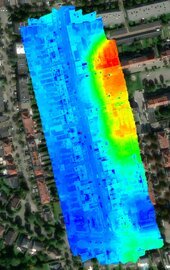
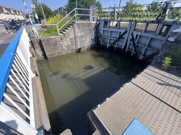
In 2018, we were entrusted with conducting the 0-measurement for the Oosterweel works on the left bank of Antwerp. This pivotal project allowed us to capture the project's initial phase with precision and detail.
We proudly introduced Belgium's first RTK drone to the site, marking a milestone in our ability to deliver high-accuracy surveys. With cutting-edge technology, we provided detailed insights that laid the foundation for the project's ongoing success.
Discover how we documented this significant moment in time!
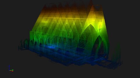
Precision scanning for visionary conversions
With the Elios 3 we safely capture a precise 3D scan of the historic church, providing the foundation for its future transformation into a swimming pool
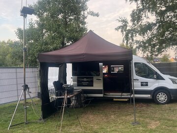
Security at Tomorrowland - Event Security 2.0 – Our Technology
Your Safety -
Maximum control with high-tech drones and mobile command vehicles
. At large-scale events like Tomorrowland, safety is everything. Our advanced security solutions combine cutting-edge drones, real-time video streaming, and fully equipped mobile command units. The result? Complete situational awareness, faster incident response, and a safer environment for all attendees.
Our Approach: Smart, Fast, Scalable
Autonomous drones with live video feeds.
Our drones patrol the area autonomously or via remote control. Equipped with 4K cameras, thermal imaging, and AI-based analytics, they detect suspicious activity quickly—even in dense crowds.
Mobile command vehicle
. Our specially outfitted vehicles act as mobile control centers. With powerful antennas, monitoring systems, and live feeds from drones and bodycams, we direct security teams in real time based on actionable data.
Live streaming & data analysis
All footage is streamed live to security coordinators and, if required, to police or event management. Intelligent software automatically flags abnormal behavior, crowd surges, or safety threats.
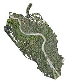
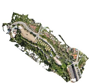
Aqualia
For Aqualia we made an overview of active works in an Urbanization in Spain
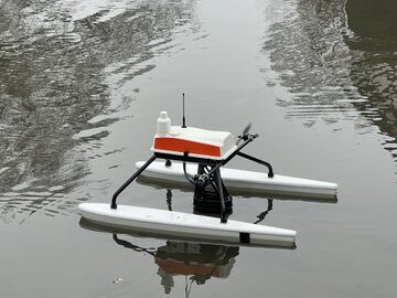
Discover the Depths of Your Lake: Advanced Bathymetry Services
Understanding the true landscape beneath the surface of a lake is essential for a wide range of applications— from water quality management to recreational activities and environmental conservation. Bathymetry, the science of measuring lake depths and mapping underwater features, provides the detailed information needed to better manage and protect these vital freshwater resources.
At Dronecheck we specialize in high-precision lake bathymetry, using cutting-edge sonar and geospatial technologies to create accurate and detailed depth maps of lakes, reservoirs, and ponds. Whether you're a water resource manager, a researcher, a fisherman, or someone interested in preserving the beauty of your local lake, bathymetric data is an invaluable tool for understanding and maintaining healthy aquatic environments.
Why Lake Bathymetry Matters :
Water Quality Management: Identifying submerged features like sediment buildups, underwater springs, and thermoclines that affect water circulation and quality.
Recreational Safety: Ensuring safe boating, fishing, and other water activities by mapping shallow areas, submerged hazards, and navigation routes.
Ecological Research: Understanding lake ecosystems, from fish habitats to aquatic plant growth, and how lake depths impact water temperature, oxygen levels, and overall health.
Flood and Erosion Management: Helping to assess risks related to flooding, sedimentation, and shoreline erosion by analyzing lakebed features and topography.
Explore our lake bathymetry services to unlock a deeper understanding of your lake's ecosystem and manage it more effectively. Whether you're looking to improve water quality, enhance recreation safety, or protect the environment, our detailed lake maps provide the insights you need.
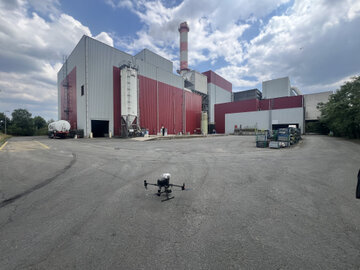
Thermal Mapping
Last week we performed a mission to make a thermal map.
A "thermal map" typically refers to a visual representation that shows temperature variations across a surface or area. These maps are often created using thermal imaging cameras or sensors that detect infrared radiation emitted by objects, with warmer areas showing up in different colors compared to cooler regions. Thermal maps are widely used in various fields, such as:
Building Inspections: Identifying heat loss, insulation issues, or water leaks in structures.
Energy Audits: Visualizing energy efficiency and pinpointing areas that may require repairs or upgrades.
Environmental Monitoring: Studying heat patterns in natural landscapes or urban areas.
Industrial and Mechanical Inspections (Elios 3): Detecting overheating components or equipment failures in machinery.
Do you have a specific context or use case in mind for a thermal map? I can provide more details based on your needs!
Lidar
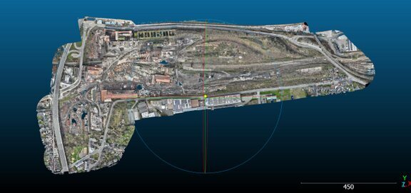
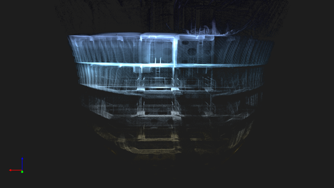
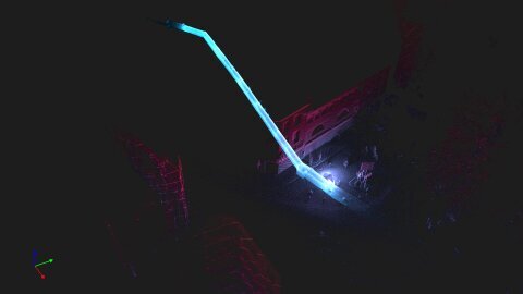
Survey of the Cockerill Sambre Site
We were commissioned to conduct a comprehensive survey of the historic Cockerill Sambre site. Our client required a high-precision LiDAR mission, integrated with photogrammetry for detailed data capture.
Leveraging our advanced P1 and L2 payloads, we delivered highly accurate results that ensured optimal data quality.
For more information on the survey and how our solutions can support your project, please don’t hesitate to contact us.
Parking and River in Spain
For a manjor Spanish company we did do a full topografic project
Emission Mapping
If you need a detailed map about emissions ?
Don't hesitate to contact us. We provide you with a detailed map up to 9 gasses.
Don't hesitate to contact us !
Don't hesitate to contact us. We provide you with a detailed map up to 9 gasses.
Don't hesitate to contact us !
ROV
Dronecheck - Comprehensive Drone & ROV Services
Dronecheck is a leading provider of a wide range of drone services, specializing in precise aerial solutions for various industries. In addition to our drone services, we also offer expert inspections using our Remote Operated Vehicles (ROVs) for underwater applications.
For more information about our services or to discuss how we can assist with your specific needs, please feel free to contact us.
Maritime
Maritime Inspections – Ballast Tank Inspection
During our recent maritime inspection, we conducted a thorough examination of a ballast tank, capturing the process in a detailed video for enhanced clarity and documentation.
For more information on our maritime inspection services or to learn how we can support your needs, please don’t hesitate to contact us.
Inspectie Monument
Inspectie van een monument
Smart Sewer Surveys with Drones – Safe, Fast & Cost-Efficient
With our Elios drone, we map underground sewers safely and accurately. No need to send people inside—our team collects all required data quickly and cost-effectively for engineering and design studies. Safer, faster, and more affordable – with reliable results.